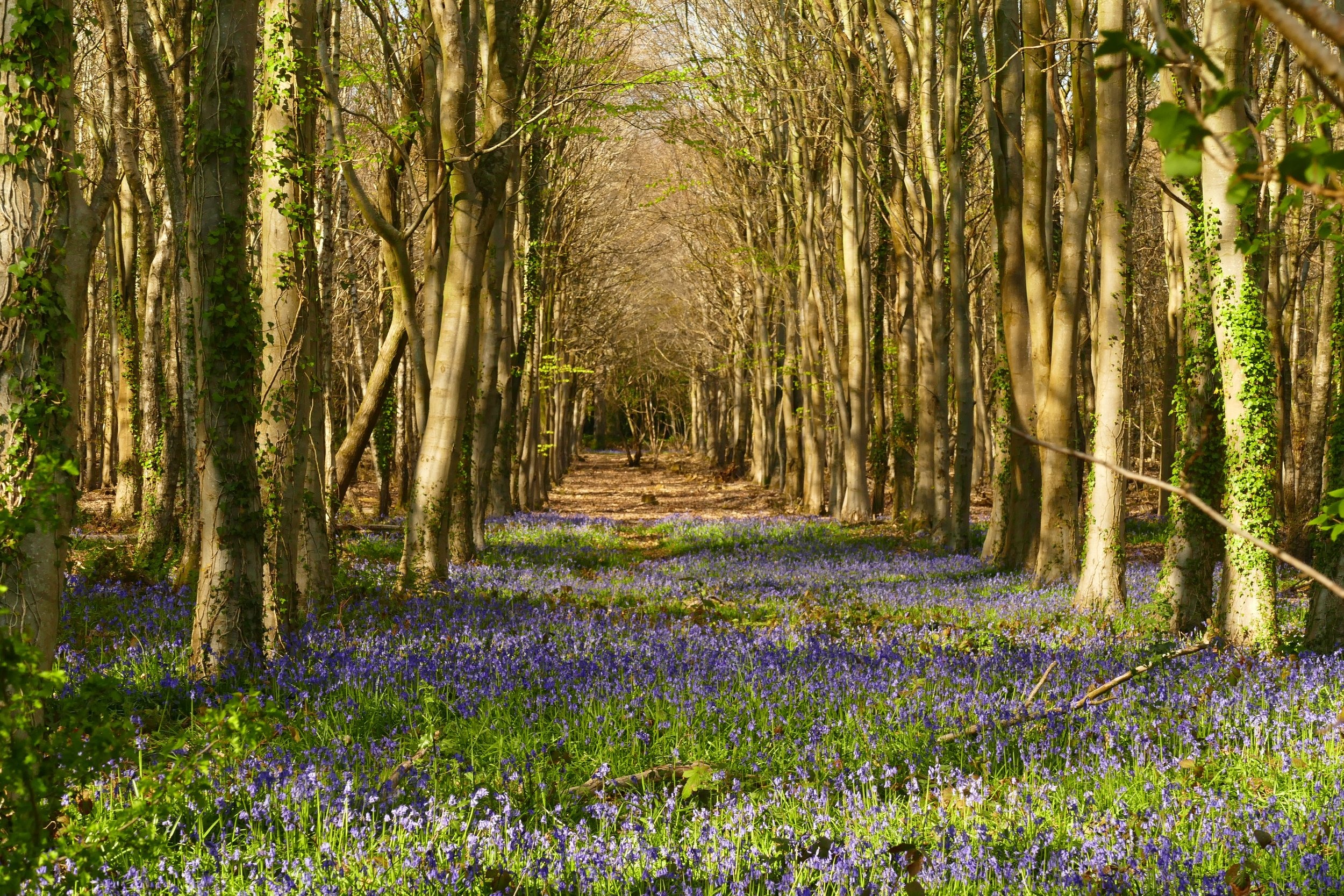
Hazeley Heath
Hartley Wintney
On this walk, children will enjoy searching for remnants from WW2 tank training as well as a peaceful little play area surrounded by woodland.

The original gatehouse to Bramshill, now a police training college
The Basics
Time: 1 hr 50 mins (there are some options below for making quicker)
Distance: 6.3 km (there are some options below for making shorter)
Terrain: Mostly flat heathland paths that can be very muddy in winter, some boardwalks, two busy road crossings.
Pushchair: Not for the walk detailed below from the pub, but there are some pushchair friendly paths on the Hart District Council managed south eastern side of the Heath. This area is also where the play area, boardwalk and WW2 remnants are found.
Dogs: Must be on leads on the RSPB managed reserve on the north western side of the heath. Cows graze areas of the heath.
Refreshments: The Mutton in Hazeley Heath with a gorgeous garden with countryside views.
Toilets: None, unless visiting the pub.
Public Transport: There is no suitable public transport to this location.
Parking: We parked at The Mutton in Hazeley Heath, where we had lunch (Postcode: RG27 8NB - W3W: copiers/members/flamingo). If you don’t plan to visit the pub, there is also a small layby on the B3011 at the junction with Arrow Lane. Use this to explore some pushchair friendly paths too (W3W: ///lawyer.playoffs.whizzed). Alternatively, you can use the pay and display car park in Hartley Wintney and access the walk via Springfield Avenue.

The garden at The Mutton in Hazeley Heath
Our walk started at The Mutton, a gorgeous pub with stylish country interiors and one of he nicest pub gardens we have seen. It then headed across the adjacent Hazeley Heath which is split onto two parts. One is a wilder, less visited RSPB managed reserve and the other, a council managed heathland with more accessible pathways. The latter also has some interesting WW2 remnants and access to a quiet woodland play area.
The Route
Our route starts from The Mutton in Hazeley Heath. With the pub to your left, walk along the quiet lane towards the busy B3011. When you reach the edge of the road, cross with care and look for a footpath almost immediately opposite. It is a little hidden by the trees and goes up some wooden steps cut into the bank.
Emerge through the trees and turn left when you hit an access track. Pass Apple Tree Barn on your left and continue along the track. Keep going all the way to the end of the gravel drive where there is a house with a green fence and some white wooden stumps. Go straight on and you will see a footpath marker that veers you off to the right.
Pass a pond to your left and continue over the wooded heath, following a line of telegraph poles. Go straight over at another access track. When you almost hit the boundary fence, turn right and walk past the historic gatehouse to Bramshill on your left. Go forward towards an RSPB information board and go straight on to join the heath.
The paths in this part of the heath are less ‘managed’ and can be muddy in parts. In winter, you may find yourself needing to pick your way along the best route to avoid the mud. It is wonderfully peaceful though, and on a warm sunny Sunday, we didn’t spot another person along this section. When you spot the large pond, you can go down and have a look. After the pond, head back up to the path and continue making your way along it in the same direction as before. Ignore the blue bridleway marker to your left, and keep going forward as the path begins to widen through an area cut through the gorse. Cross over a tarmac drive and veer left to join the footpath that is parallel to the fence as this is an easier path to walk on and follow from now on (if you want a shorter walk, follow the tarmac drive to the other side of the heath. Turn right at the end and complete the walk as in section eight below) .
At Purdies Farm, turn right along the track and then go left when you see telegraph pole number nine (continuing straight here would also be another way to cut the walk short and return as per section 8 below). Go over a little railway sleep bridge over a stream and then emerge out onto far more open heathland than before. You are now on the Hart District Council side of the heath and will find more managed paths as well as meeting more walkers. Continue forward over a section of boardwalk. At the telegraph pole positioned at the end of the boardwalk, veer right, going away from the footpath arrow.
Go over two more small sections of boardwalks, then turn right up the hill when you hit the gravel path. At the top of the hill you will find some remains of where the military used to test out their tank winches during the Second World War. There is a really steep concrete runway where they would practice winching up the machines and some rusted tank tracks that children will enjoy investigating, as well as an information board giving more details about the wartime history of the heath. Continue straight on along the concrete path and the go right at the junction (If you go left here, you can soon reach a little play area. Follow the yellow footpath badge at a fork, then where a number of paths meet, go right through a wooden gate. Follow the path down through the trees to find the play area and then return the same way.)
Continue straight when you reach another information board. Cross an access track and re-enter the RSPB section of the heath on the other side.
Cross the tarmac track when you reach it and continue along the bridleway on the other side. Pass two gates very close to each other that exit onto the road by a bus stop and mounting blocks. Stay on the heath and veer down to the right to find a better path. This part of the route begins to get very tricky to describe accurately. The formal paths diminish and the area is quite wet in winter. We ended up picking our way from path to path, avoiding the mud. It would be near impossible to describe exactly which path to be on. We used our OS map that pinpoints our location, but if you don’t have a map, you will need to use the fence and the road beyond as your reference. You need to keep the road as close as you can to your left. You will pass another exit gate, which you should ignore. The exit gate that you want to take will lead you to the road and straight across it to Hazeley Court. There are some bins marking the entrance too.
As the access track bends left to Hazeley Court, turn right along the path (not ahead on the footpath). The entrance is marked by two concrete cylinders. Keep going straight as the path crosses an entrance track, and then at the next entrance track, turn right and then left to go around the central ‘triangle’ and find the path again on the other side, continuing in the same direction. The path will eventually lead you to a road.
Turn left at the road, and then right at the junction to return to The Mutton.


Did you know?
Hazeley Heath is now a site of special scientific interest due to its rare lowland heath habitat. But it has not always been this way, it was oce a racecourse in the early 1800s, gravel-digging pit in the late 1800s, municipal rubbish dump in the 1920s-60s and an army training location in World War II.
We are passionate about keeping The Ambling Path as a free resource available to everyone, forever. If you have enjoyed using our walking guides, then please consider leaving us a donation. This will help to cover our costs as well as rewarding the considerable time and effort needed to maintain the site. Thank you.
Follow us on social media to see our new walks and get regular updates on our old ones: