Flood Meadows
Alton
Children will enjoy two play areas on this walk and the viewing platforms and boardwalks of Flood Meadows.

Flood Meadows is a recreational space on the edge of town
The Basics
Time: 1 hr 15 mins
Distance: 4.2 km
Terrain: Some uphill sections, some quiet country lanes and occasionally muddy tracks.
Pushchair: Only for the section around Flood Meadows and up to Greenfields play area.
Dogs: Dogs will need to be on leads through farmland with cattle and around Flood Meadows where there are more people.
Refreshments: There are no refreshments on the walk, but Alton town centre is a short walk away from Flood Meadows. Alternatively, there is a picnic bench carved with wooden animals in Flood Meadows.
Toilets: There are no public toilets on this walk, the nearest are at the public gardens in the town centre.
Public Transport: You could get the train to Alton Station and then follow the Wey Walk walk from Alton train station to Flood Meadows.
Parking: We parked for free at the side of Basingstoke Road between the Odiham roundabout and the junction with Ackender Road (Postcode: GU34 1QB - W3W: ///divding.gangway.domain). If this section of road is full, you can park at the pay and display Ladyplace car park and walk the short distance to Flood Meadows (Postcode: GU34 1HH - W3W: ///reprints.imparts.backers)

Flood Meadows
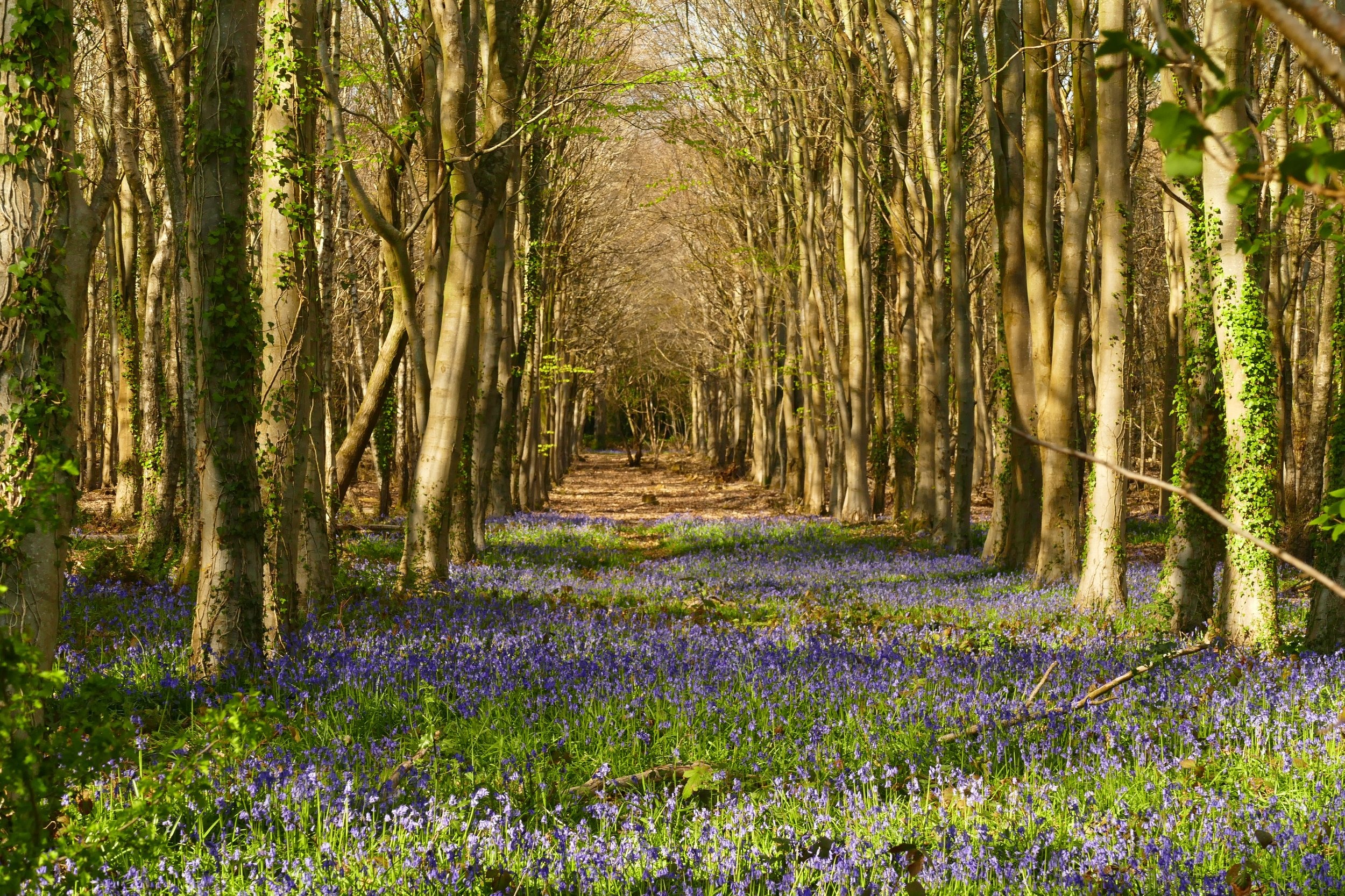
Flood meadows is an absolute gem on the edge of Alton. Close to its source, the River Wey flows through this recreational space where dogs and children can splash, picnic and see the ducks. Our route then explores the surrounding countryside and farmland with a stop at two play areas.
The Route
The entrance to Flood Meadows is at the point where Basingstoke Road becomes Lenten Street and to the side of a white cottage with a red door. Once through the arch, turn right and walk with the river to your right. Follow the path beside the river and then, as the wetland expands, follow the boardwalks over the water. Just after the viewing platform up to your left, turn left along the boardwalk and then left again at the grassy park. You can now stand on the viewing platform. Look out for the picnic bench carved with animals.
Continue walking, now in the direction of where you started, with the water to your left. At a crosspaths, go left, following a yellow footpath marker. Then, very shortly, go right at the next yellow footpath arrow, next to a doo poo bin. This is a much rougher path than previous ones and goes up through trees (pushchairs could use the surfaced path to the side of the trees). Walk up towards the houses and keep right when you see a footpath marker tacked onto the end of a black garden fence. With the black fence to your left, round the bend at the top. Walk up the road opposite house number 23, Jasby, passing a salt grit bin on your right and heading up towards a bus stop. Cross the road and take the path just to the right of the bus stop and to the left of a white garage door at number 92. At the top of this section, you will reach Greenfields play area. Pushchairs will struggle after this point.
Standing with the entrance to the play area on your right, you will see a kissing gate ahead of you. Ignore the kissing gate and take the path to the left of it with a yellow footpath arrow and a countrywatch sign. Follow the path and where it descends, go through a metal kissing gate and walk through the trees at the top right of a field (highland cows in this field). Go through the gate at the farm and follow the footpath across the farm track and then up to the road.
Cross the busy road with care and walk up the much quieter Southwood Road opposite. Walk along the side of the lane as it climbs the hill and then turn left at the top onto Brick Kiln Lane. Pass a large barn to your right and a fertilizer silo to your left. Continue along this track until it turns to tarmac on the approach back to Alton.
Just after it becomes tarmac, look out for a footpath post on your left with steps going up the bank into a field. Turn right at the field and head towards some new tree planting. The path will become surfaced and will lead you to a housing development. Go straight down the hill and meet a play area. Go straight across the play area and then turn right when you meet the pavement on the other side. Follow the residential road down towards the river. At a sign for Minstrel Close enter the nature area and cross the footbridge. Turn left on the other side and return to your car/Flood Meadows.


Did you know?
Up until the 1950s the land around Flood Meadows was used to grow watercress, known as ‘Weycress’.

If you enjoyed this walk…
…try this one in the nearby village of Holybourne
We are passionate about keeping The Ambling Path as a free resource available to everyone, forever. If you have enjoyed using our walking guides, then please consider leaving us a donation. This will help to cover our costs as well as rewarding the considerable time and effort needed to maintain the site. Thank you.
Follow us on social media to see our new walks and get regular updates on our old ones: