St. Martha’s Hill
Guildford
Children will enjoy finding a hilltop church, as well as possible extensions to a pub with a river in the garden and the ruins of Chilworth Gunpowder Mills.
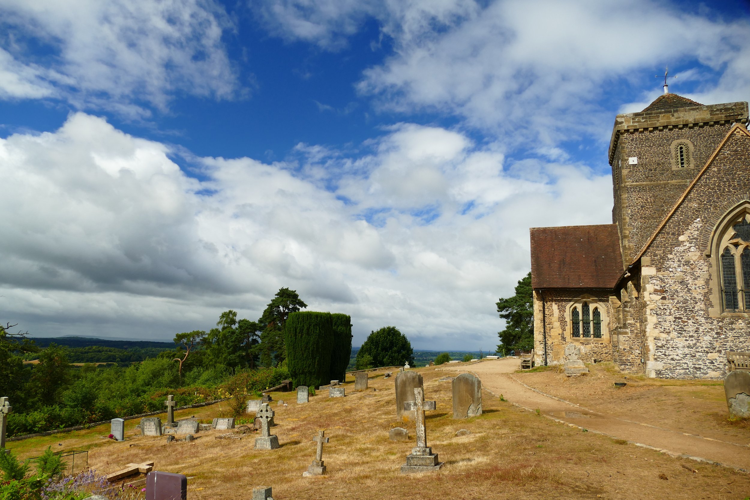
St Martha's Church has views across the Surrey Hills
The Basics
Time: The basic loop to the church will take no more than half an hour, but see below for various worthwhile extensions to the walk.
Distance: The basic loop to the church is about 2 km, but see below for various worthwhile extensions to the walk.
Terrain: The basic loop has some gentle inclines and mostly sandy, firm paths. The extensions have more challenging inclines and terrain, see below.
Pushchairs: Even on the basic loop, the paths would be too sandy. However, if you just wanted to walk up to the church from the car park and back, the path just to there is wide and firm.
Dogs: Yes, and the pub is dog friendly.
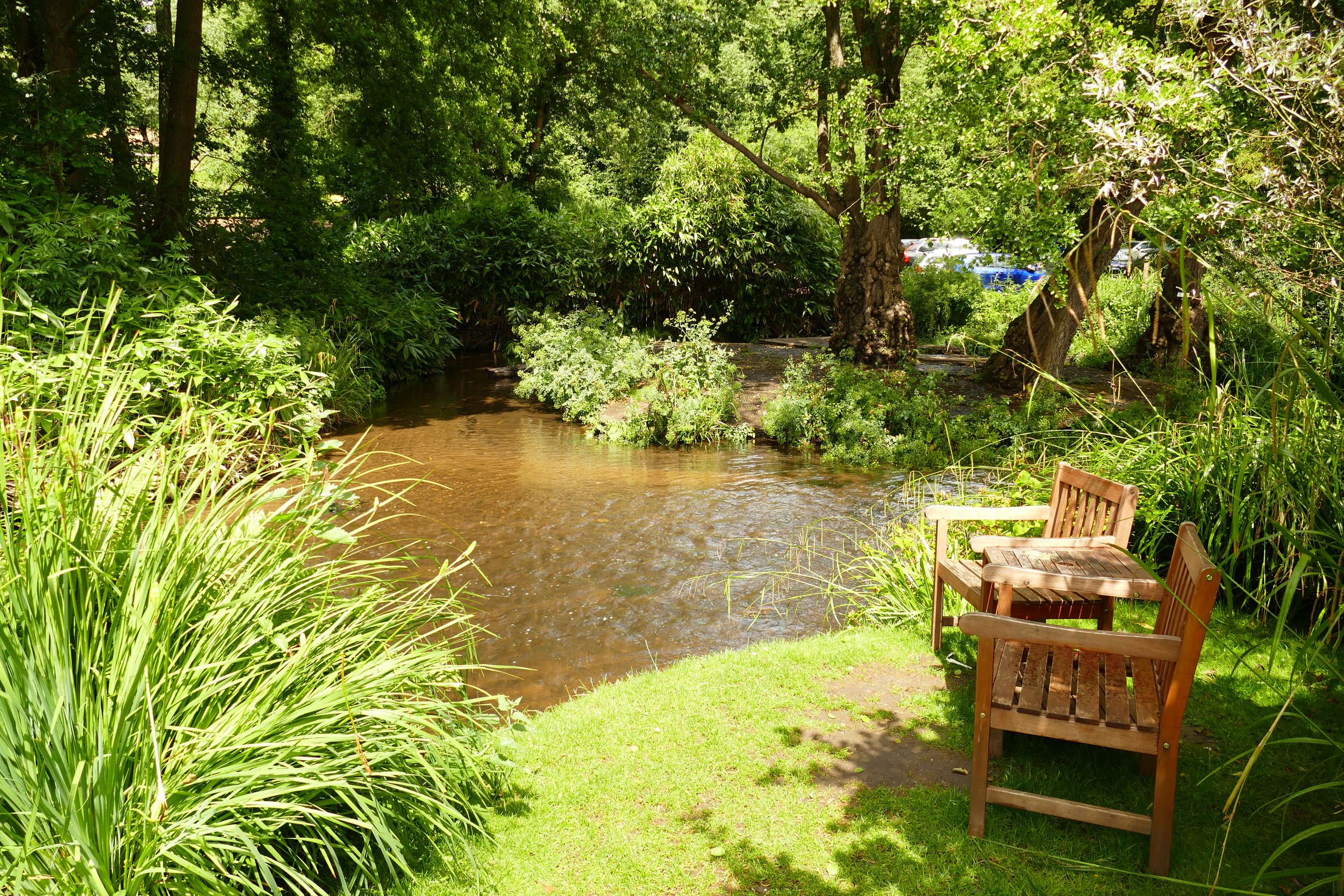
Refreshments: One extension to this route includes a stop at The Drummond in Albury, with a riverside garden.
Toilets: None.
Public Transport: There is a train station at Chilworth from where you can join our route at Chilworth Gunpowder Mills via Vera’s Path from the village
Parking: Free Car Park on Halfpenny Lane (Postcode: GU4 8PZ - W3W: unless/feast/behind)

There are Surrey Hills views throughout the walk
Just a stone’s throw from Guildford, St. Martha’s Church stands in a commanding position on a hilltop with no road access. Our simple loop takes you up to the church and back through sandy woodland. If you want something more adventurous, we also give you options to walk to mill ponds and a pub at Albury as well as one of our other popular walking locations, Chilworth Gunpowder Mills.
The Routes
Route One - St Martha’s Hill to the church and back
30 mins
2 km
Sandy paths, gentle inclines, some rougher sections
For a simple route around the church, leave the car park up the main path, The North Downs Way, which heads away from the road behind the information board. This path is initially suitable for vehicles, so is wide and firm. It will take you straight up to the church.
You will no doubt want to go inside the churchyard and sit on the many benches and enjoy the views. When finished, leave the churchyard through the little wooden gate at the opposite end and continue along the path with the views to your right.
The path will start to steadily descend and you should look out for the first path on your right, signed as a bridlepath. This sandy path will take you back in the direction of the car park by going just beneath the church.
Extension A to Route One - Chilworth Gunpowder Mills added to St.Martha’s Hill
3 km
1 hour
Steep incline
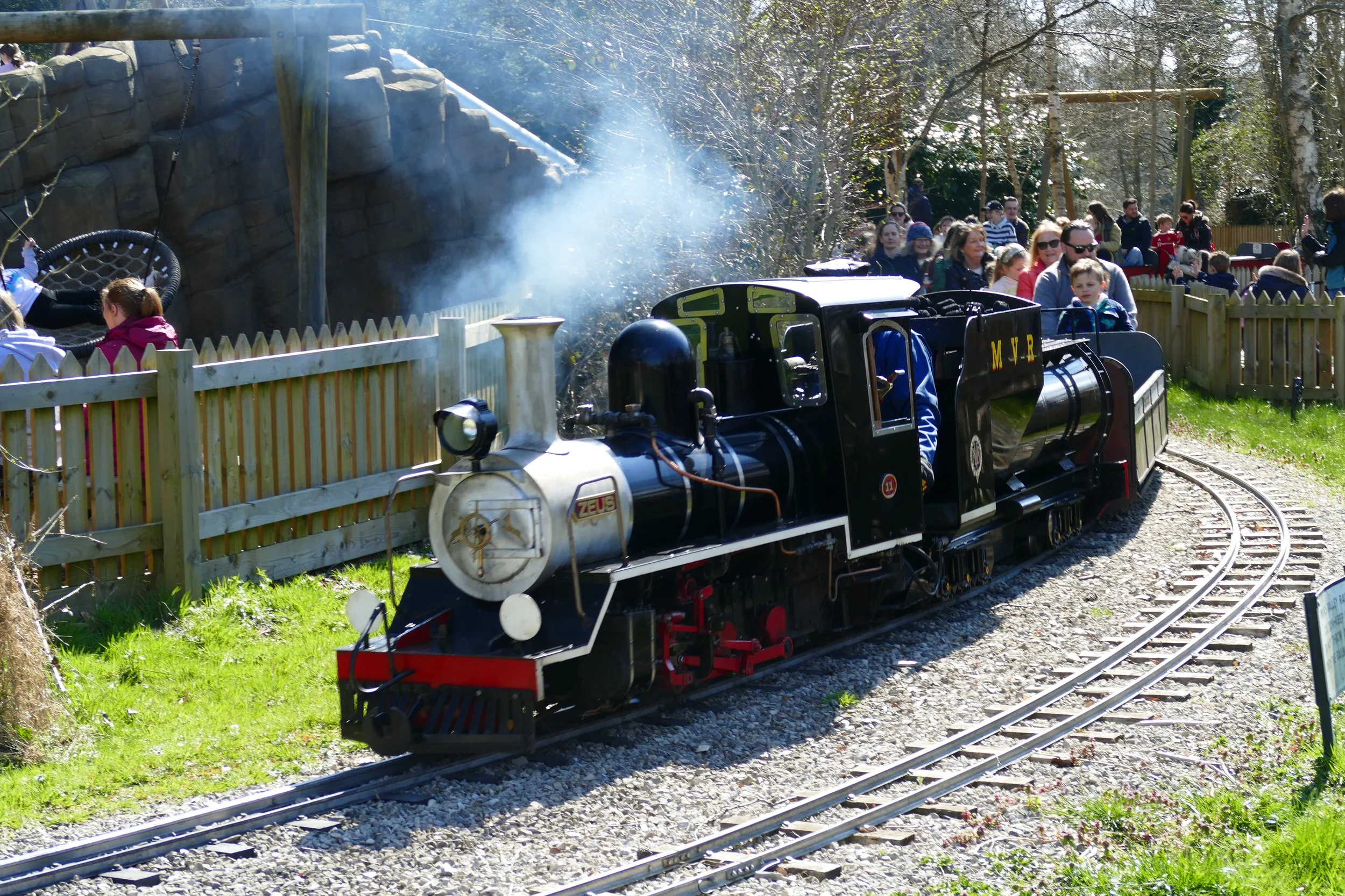
As you return to the car park along the path described in section three above, you will spot a footpath on your left about half way along. This will descend steeply into the site of the ruins of Chilworth Gunpowder Mills. You will find ruins from our industrial heritage scattered throughout the trees as well as a picnic area and designated paddling spot for children. You can use the map on this link to explore the area. Remember - it will be a steep climb back up!
Extension B to Route One - The Chantries added to St.Martha’s Hill
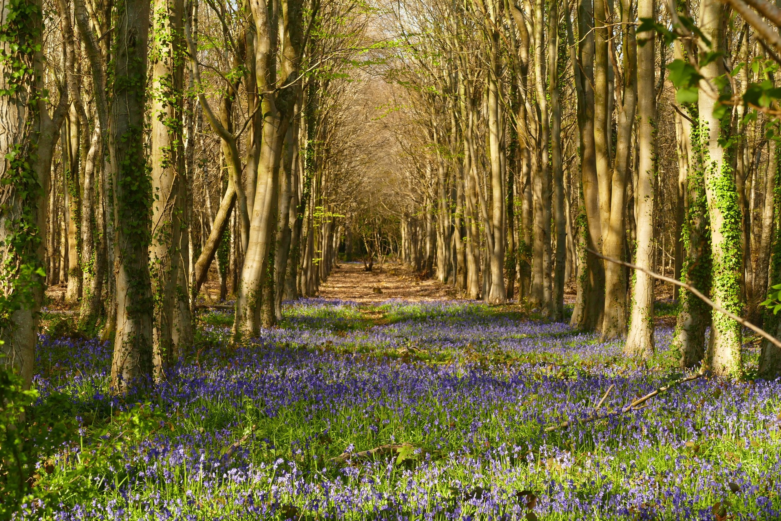
Just across Halfpenny lane, you will find an entrance to The Chantries, also known as Chantry Wood. In late April/early May, you will see one of our favourite displays of bluebells in the woodland. If coming to the woodland in spring, this is an essential addition to the walk! It takes minutes on flat terrain to get to the wood and you can walk for as long or short as you like.

An easy extension to St Martha’s Hill is Chilworth Gunpowder Mills. Click on the photo to see more about this walk.

In season, a lovely extension to this walk is The Chantries to see bluebells. Click on the photo to see more about this walk.
Route Two - St Martha’s Hill to the millponds
5.7 km
2 hours
Some steep terrain and stiles
Leave the car park by following the main path, the North Downs Way, that heads away from the road behind the information board. This wide, firm path will take you straight up to the church.
After enjoying the church continue along the North Downs Way through the sandy woodland paths. Initially there will be views to your right, but then you will go deeper into the trees.
You will pass and old WW2 pillbox and should go straight ahead at a cross paths with the Downs Link. Continue until the next cross path. Here the paths will all narrow and you need to take the right hand footpath, just after a large oak with low branches. This path will narrow between vegetation and head down hill.
The path will be noticeably rougher than the ND Way and will make its way down the wooded slope. When you meet a fence at the bottom, turn left and continue into Colyers Hanger.
The hanger is full of beech trees and as you walk, you should start to see the glimpses of The River Tillingbourne down to your right. The path will continue through the hanger for some time until you meet some wooden sleepers in the path and a paved access road beyond.
Straight ahead of you will be Waterloo Pond. Take the path to the left of the pond, over more wooden sleepers. The path will emerge into a garden and it certainly gives you the feeling that you are trespassing! Be assured this is the path, and follow the little steeping stones across the lawn in the direction of the house. The path goes between the house and the pond before passing a few more houses on a gravel drive and then emerging at the A248.
Turn right at the road and then almost immediately turn right again to take the footpath along the opposite side of the pond, heading back in the direction you came. At the end of the pond, continue straight ahead along the paved Mill Lane with the river to your left. You will soon reach Postford Pond on your left.
As Mill Lane curves to the left, look out for the sign to Postford Mill Cottages on your right and the footpath just opposite. The footpath is narrow as it travels in a straight line between two sets of fences. This section of path will end with a stile over a stream (you can actually go around the stile if you wish).
Head out into the field and cross it by following the worn path parallel to a ditch in the middle of the field. On the other side, cross another stile and then another field. On the other side of this field section, head out onto Lockner Farm Lane and turn right.
Continue straight past a private entry sign to Longfrey Farm and begin the climb back upwards. At the fork, turn right and follow the Downs Link path up the hill. Further up, ignore the steps to the left and stick with the main path. Continue your way back up St. Martha’s Hill until you reach the sandy, woodland path of the North Downs Way again.
Turn left here and either walk back through the churchyard again, or take the bridlepath on your left just before the church to give a variant back to the car park.
Extension A to Route Two - St Martha’s Hill to the millponds plus The Drummond gastropub in Albury
0.8 km each way
15 minutes each way
Pavements
To visit this gorgeous riverside gastro pub you will need to make a diversion when you reach the A248 at the end of Waterloo Pond in section 6 above. Instead of turning right and heading back along the other side of the pond, continue instead across the road and join the pavement. Walk in the direction of Albury and you will find a pavement the whole way. If visiting the pub in the summer, be sure to book a table outside. Children will love the river running through the garden! You will need to return the way you came and re-join the walk at point 7.
Extension B to Route Two - St Martha’s Hill to the millponds and Chilworth Gunpowder Mills
Add an extra kilometre at least
Add an extra 20 minutes minimum, but more depending on how much you explore
When you arrive at Lockner Farm Lane in point 9 above, you can turn left (although the gunpowder mills are also marked to the right of the lane, only the area to the left of the lane is on public land) and explore Chilworth Gunpowder Mills. You can use the map on this link to explore the site which contains ruins from our industrial heritage scattered through the woodland. There is also a picnic area and designated paddling spot for children. You have the option to return by the path described in section 10 above or by the more direct, but steeper path going straight back up to the church.


Did you know?
It is claimed that one a clear day, you can see eight counties from the top of the hill. I personally think some of these might be a stretch, but the claim is Surrey, of course, then Oxfordshire, Buckinghamshire, Berkshire and Middlesex to the rorth, Greater London to the east, Sussex to the south and Hampshire and Wiltshire to the east.

If you liked this walk…
…try this one at Newland’s Corner. It is a short distance away and information boards will even show the more adventurous walker how to hike between the two.
We are passionate about keeping The Ambling Path as a free resource available to everyone, forever. If you have enjoyed using our walking guides, then please consider leaving us a donation. This will help to cover our costs as well as rewarding the considerable time and effort needed to maintain the site. Thank you.
Follow us on social media to see our new walks and get regular updates on our old ones: