Fordingbridge
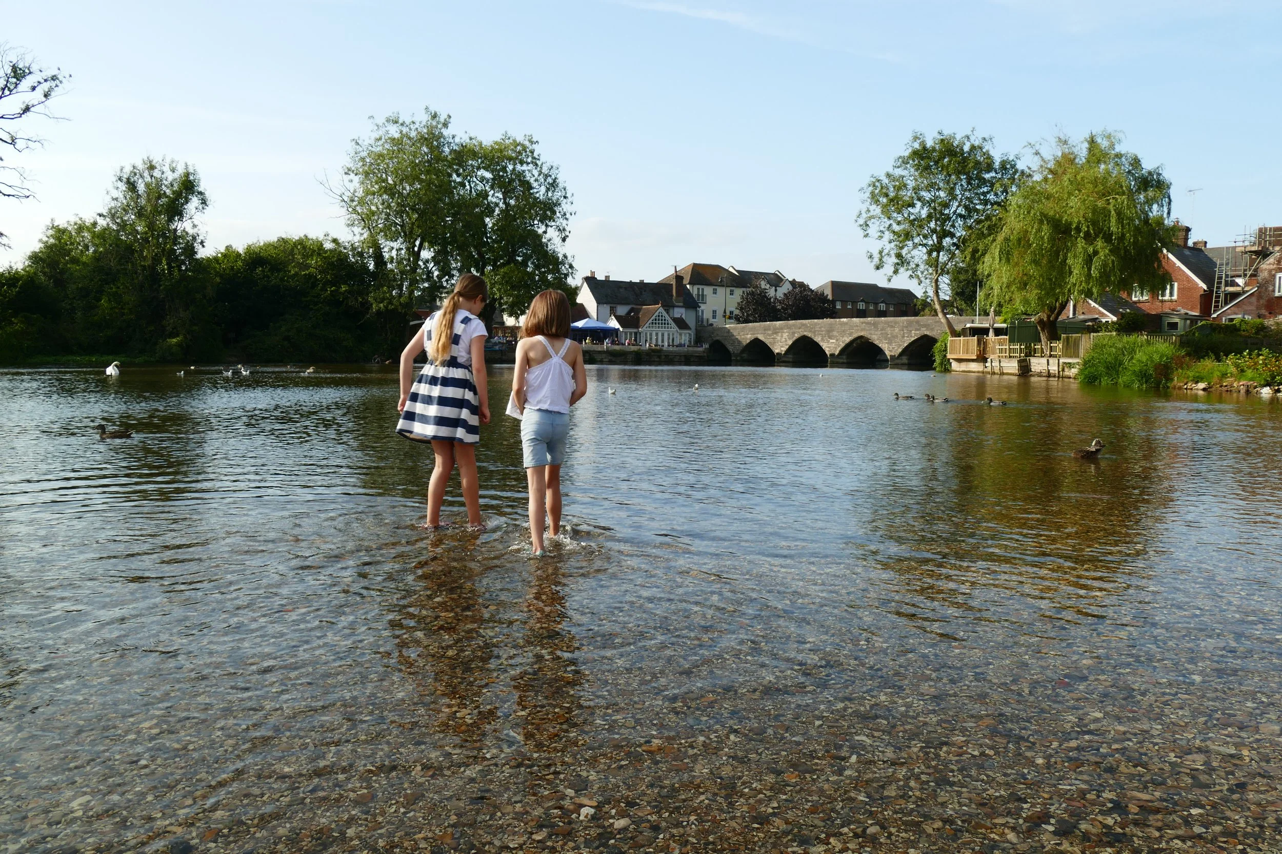
Children will enjoy a huge ford in the river where they can paddle, multiple parks and a paddling pool on this walk.
The wide, shallow ford at Fordingbridge
The Basics
Time: 4km in each direction
Distance: 1hr 10mins in each direction
Terrain: Flat farm tracks, water meadows and bridges that could be wet in winter. Busy road crossing, pavements and some distance through town.
Pushchair: No
Dogs: Must be on leads through farm land and are not allowed in the park beside the river in Fordingbridge. There is a free dog agility park on the walk.
Refreshments: Riverside Kiosk in the park beside the river in Fordingbridge.
Toilets: In the park beside the river in Fordingbridge.
Public Transport: The More X3 route from Salisbury to Bournemouth stops at Fordingbridge Recreation Ground
Parking: Free roadside parking at Castle Hill in the New Forest. We parked in one of the bays at the side of the road opposite Ardens Lodge just before Folds Farm. Please don’t park on verges or block gateways. If you would rather an official car park, there is one further up Castle Hill, where there are great views, but we avoided this as it meant the walk would have ended with a hill climb for the children (Postcode: SP6 2LU - W3W: shin/resonates/greeting). If you don’t want to do the walk, but want to visit the park in Fordingbridge, there is a pay and display car park on the opposite side of the road to the park (Postcode: SP6 1AN)
The paddling pool at Fordingbridge Recreation Ground
We wanted to enjoy the brilliant park in Fordingbridge, which has a range of play equipment and a paddling pool beside a wide, shallow ford in the river. As Fordingbridge sits on the edge of The New Forest, we decided to park up there and walk into town from the forest along the water meadows of the The Avon Valley Path.
The Route
Before following this walk, you should be aware of a few things. Firstly, it is linear and you will need to return the way you came so distances and timings will need doubling. The first half of the walk is beautiful as it tracks from the edge of the forest over water meadows and brigdes with clear river streams and plenty of wildlife in view. The second half of the path has been swallowed up by new housing and a large portion of the route involves walking on pavements through the town. The payoff for that fact is that you will pass no less than four play areas before even making it to the fifth play area beside the river!
We decided to join the long distance Avon Valley Path from the edge of Godshill Inclosure which would take us into Ringwood. As detailed above, there are parking in bays at the side of the road or an official car park on Castle Hill, where there are great views but with an added hill climb. The aim is to join the path at Fold’s Farm, so parking as close as you can get to there is our advice. The footpath can be found by walking straight through the main entrance to Fold’s Farm.
Follow the footpath through the farm, with their lovely private garden to the left and then a livery yard to the right. There will be two footpaths leading off to the left, but you should ignore both of those and stick to the most direct and straight path through the farm buildings. The farm buildings will thin out and you will pass a series of field entrances, all with names on the gates. Cross over a little bridge and a stile.
At the field named Eight Acres, go through the little gate and then over a series of three little concrete bridges. There will likely be cows here, but they were all behind the fence. We also saw a huge number of ducks gathering on the river at this point. Go through the gate after the third little bridge and then follow the path across the meadow as it goes straight and then bends to the left.
On the other side of the meadow, you will go through another gate and straight onto a suspension bridge. It gives you beautiful views of the clear water of The River Avon, but it does have a little wobble to it! On the other side of the bridge, go right and walk straight through the collection of buildings at Burgate Manor Farm. At the entrance to the farm, you will find yourself at Ringwood Road. This is a busy road, so turn left along the pavement so that you can utilise the island to cross.
On the other side of the road, walk straight ahead with the school to your left and the new housing to your right. Turn right into the new housing at Grebe Place and look for the first play area - a small enlcosed space for toddlers. Further along, on your left, is a natural play area for older children and an enclosed dog agility exercise paddock. Walk to the boundary at the top edge of the development to re-join the footpath by turning left where you see signs for The Avon Valley Path.
The Avon Valley Path has been swallowed by new housing throughout this section. More houses are going up on land to the right of the path and there are already houses completed to the left. Look for the junction where there is some Heras fencing and occupied housing to the left and newly developed land to the right. The path is unmarked, but will lead away to your left with a newly laid surface.
As you walk along with the new houses to your right, you will find the next brand new play area called Augustus Park. Keep going after the play area until you hit the road again.
Turn left and follow the pavement along Whitsbury Road. Almost immediately, you will pass yet another play area and stream on the other side of the road called Sweatford Stream Play Area. At the end of Whitsbury Road, turn left into Green Lane and then right along Salisbury Street to arrive at the famous bridge with seven arches. Access the recreation ground, play area and paddling ford on the other side of the bridge.
Did you know?
The Avon Valley Path follows the river from Salisbury to the sea at Christchurch. The suspension bridge the path goes over on this route was replaced in 1950 after a tank destroyed it during the Second World War.
We are passionate about keeping The Ambling Path as a free resource available to everyone, forever. If you have enjoyed using our walking guides, then please consider leaving us a donation. This will help to cover our costs as well as rewarding the considerable time and effort needed to maintain the site. Thank you.


