Dunsfold
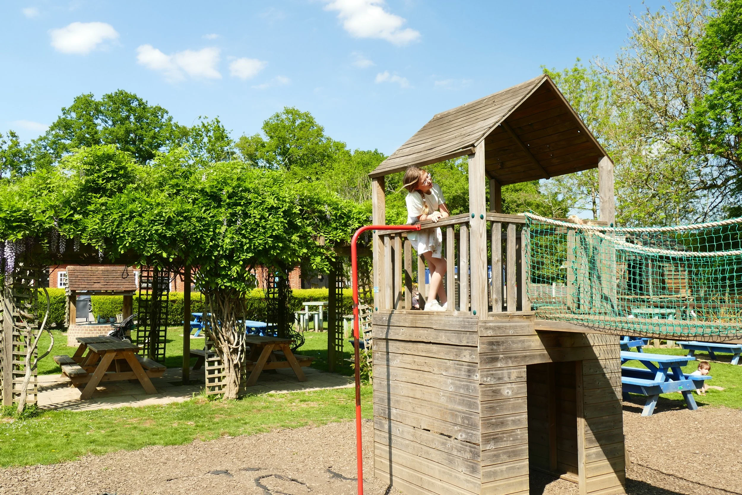
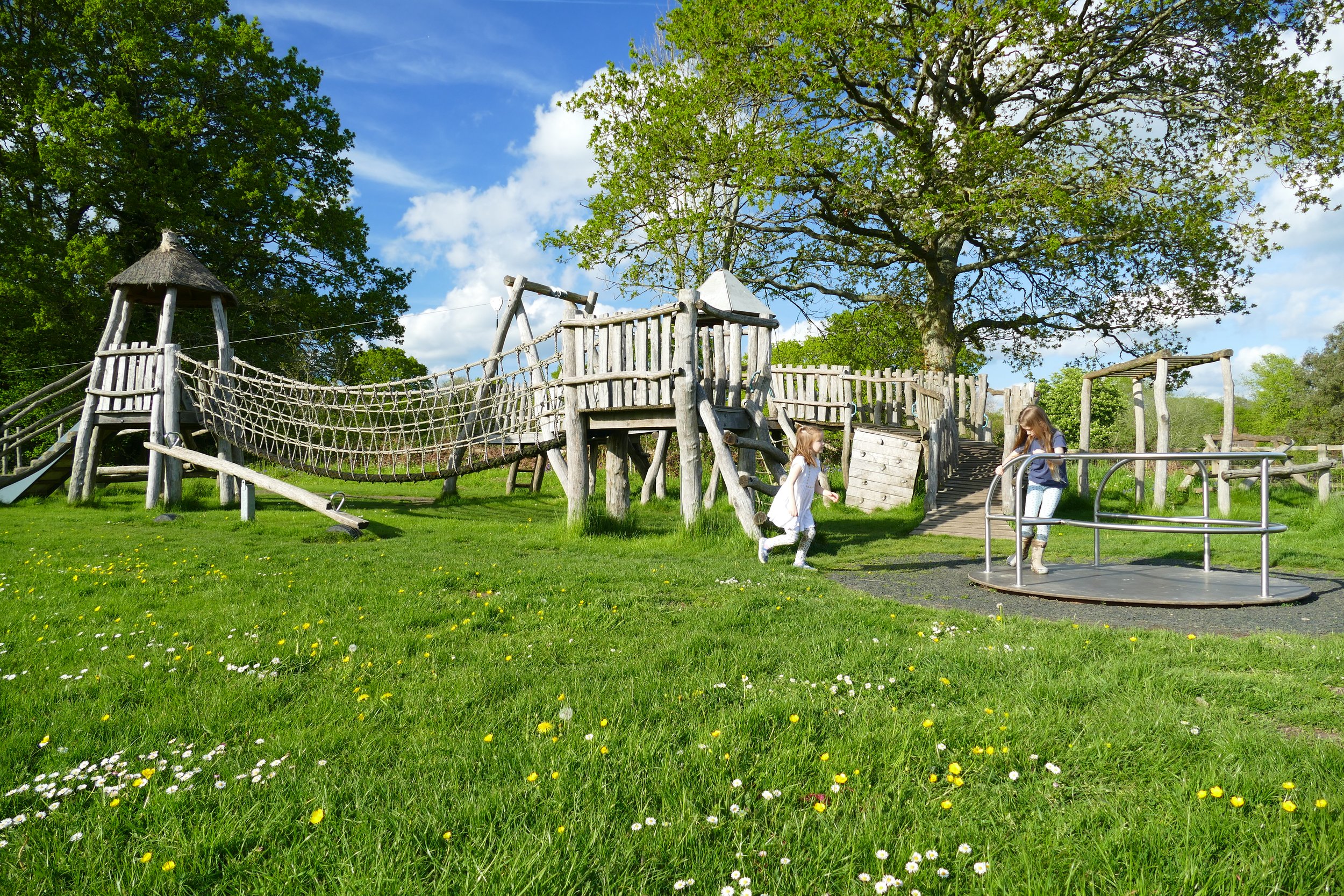
Children will enjoy the outstanding play area, nesting swans, tree swing, Holy Well and wildflowers on this walk.

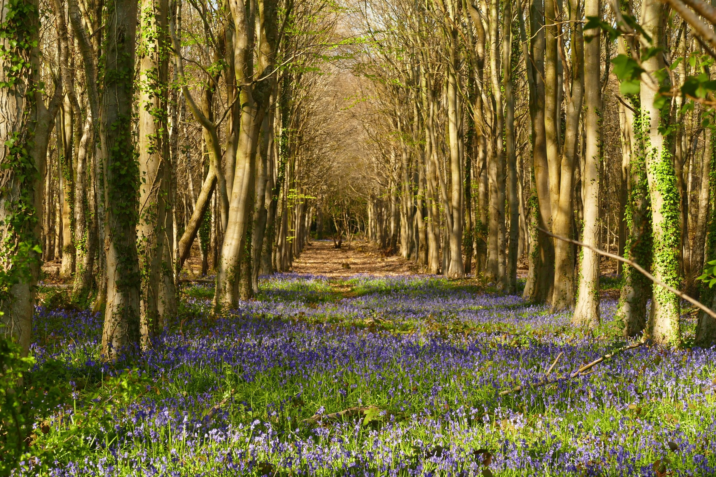
Mill Hanger is filled with wild garlic in spring
The Basics
Time: 1 hr 15 mins
Distance: 5 km / 3.1 miles
Terrain: Sometimes muddy and very narrow woodland paths, one section on quiet country roads and a field with cattle in.
Pushchair: This route is not suitable for pushchairs.
Dogs: Dogs are welcome on this walk.
Refreshments: The Sun Inn, Dunsfold, with tables spilling out onto the pretty village green.
Toilets: There are no public toilets on this walk.
Public Transport: There is no public transport to the walk, however if you just want to visit Dunsfold village, the Compass Travel route 42 from Cranleigh/Guildford/Godalming stops at the village hall.
Parking: There is space for about 5 cars in lay-by beside the church green near to St. Mary’s All Saints Church (Postcode: GU8 4LT - W3W: ///following.ambushed.digesting)

A rope swing hangs from a tree on Dunsfold village green
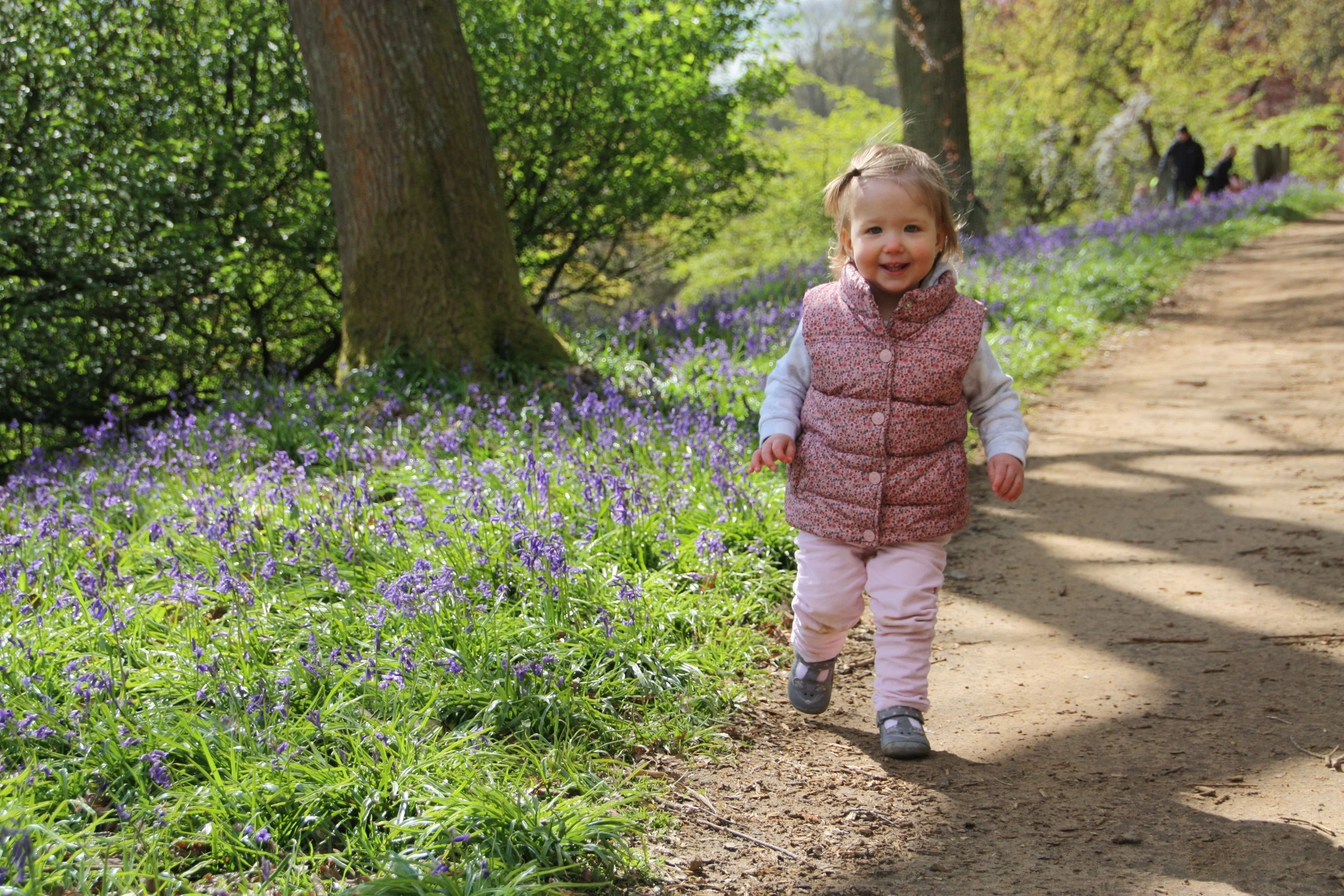
In May, a walk through the woodland of Mill Hanger near Dunsfold is like stepping into a magical fairy kingdom. Wild garlic and bluebells bloom beside the river conjuring up a sight that will take your breath away. But this walk is not without its challenges. It is extremely wet underfoot and most of the path is narrow, muddy and slippery. In addition to this there are frequent trees down across the path, which you will need to have the physical ability to crawl under and over. But fortune favours the brave, and if you are prepared for those obstacles, you will be rewarded with a walk that will stay in your memory for a long time.
The Route
From the small parking bay, head down the lane with the church on your right. The paved lane soon turns into a track and at the bottom you will find a gate. Just throught the gate is the Holy Well, the site of a spring thought to have sacred properties.
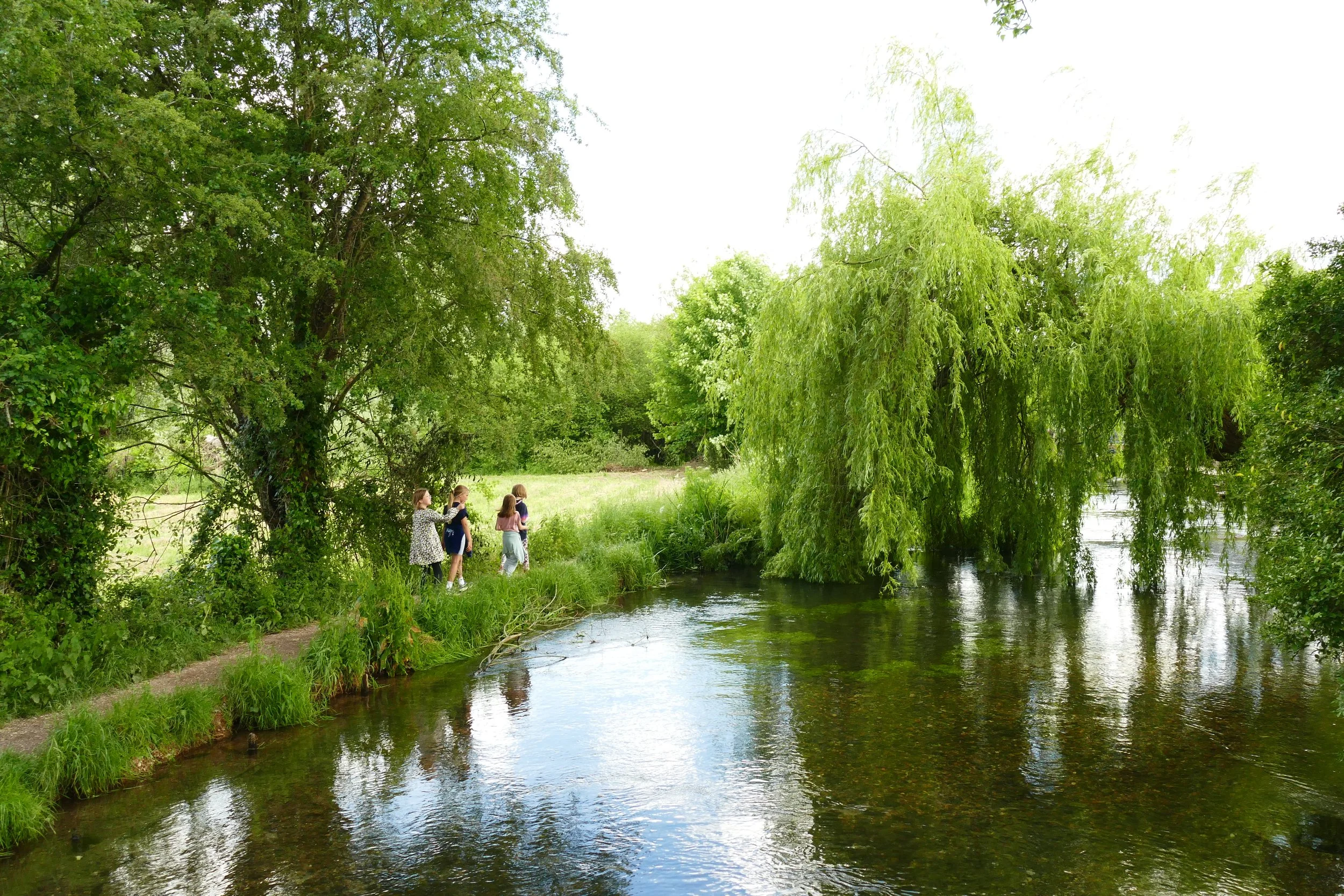
Pass by the Holy Well and continue through the field with the river in view to your right. At the other side of the field, pass over a weir and continue along the track where you will be greeted by a great deal of wild flowers in spring and summer.
You will shortly hit a junction at a wooden fence, and you should turn right towards the house. Almost immediately, turn right again as if doubling back on yourself.
Gradually rise with the track, passing by a cottage with a collection of ramshackle cars outside. Just after this house, turn right where there is a sign for Millhanger Cottage. You will soon see the modern timber cottage on the hillside and you should veer right down the footpath, avoiding the private drive up to the house on your left.
You will now be entering the woodland of Mill Hanger and you will start to discover the most prolific displays of bluebells and wild garlic. For the whole of this section of the walk you will need to stick to the same narrow path as it winds its way through the woodland. It is muddy in most parts and there is quite a large amount of treefall over the path. At times the River Lox will be in view to your right. There are no paths to the left or right, so it is easy to navigate your way along the singular path.
You will pass through Dunns Copse and then Pignuts Copse, where the tree type turns into conifer for the final hundred metres or so of the path. The sound of traffic from the road will begin to be heard as you hit a fork. Keep right here, following the footpath symbol. Shortly, you will emerge at the road.
Turn right and walk down the road. There is no pavement, but the road is wide and quiet. Cross a little bridge at the bottom of the dip and then rise up and bend to the right with the road. Follow the road up hill until you reach White Beech Farm. Turn right here and look for the bridlepath passing to the left of a post and rail fence. It feels a bit like you are entering their private property, but just make sure you are to the left of the fence to be on the public right-of-way and do not go over the cattle grid!
Follow the path to the left of the farmhouse as it takes you back into the woodland again. As before, there is only one path, so navigation is pretty straightforward. As you reach the bottom of a downhill section, you will meet a bridge over another weir. Watch children here as the water is deep and fast flowing and the barriers are pretty open!
Turn right after the bridge and go through a gate into an area where a large amount of young trees have been recently planted. Follow the obvious track with the river to your right. At the end of this plantation section, there is a new wooden bridge. Cross this and enter a field on the opposite side.
Look for the thin path worn across the field, heading towards the fence and copse on the other side. Note, there are cattle grazing in this field. Veer right when you get to the fence and stay in the field, following the path along its edge. About half through the field, look for a pair of gates on your left. The larger, five bar gate has a ‘private’ notice on it, but the smaller gate with a chain clasp on your right is the one you need to go through.
Follow the path through the little copse and then out the gate on the opposite side. The path will then pass by some paddocks with sheep and lambs in before arriving back at the church green.
If you like the look of the beautiful village green with its outdoor pub tables, ponds, meadows, village store, nesting swans, rope swing and awesome rustic playground, then all of this can be enjoyed separately to the walk. We suggest driving the short distance between the two if you have children with you to keep the overall walking distance down. The playground has its own car park, signed from the main road (Postcode: GU8 4LY - W3W: ///noble.pats.inherit).
As a member, you gain instant access to over 200 PDF files. Members also benefit from special members-only discounts at some of our favourite pit-stops.


Did you know?
Dunsfold is also home to an aerodrome, built by the Canadian Army during the Second World War, and more recently the main filming location for Top Gear, where Clarkson and his crew would use the track for test drives.

If you enjoyed this walk…
…try this one at Chiddingfold, a nearby and equally charming Surrey Hills village with lots of bluebells in spring.
We are passionate about keeping The Ambling Path as a free resource available to everyone, forever. If you have enjoyed using our walking guides, then please consider leaving us a donation. This will help to cover our costs as well as rewarding the considerable time and effort needed to maintain the site. Thank you.
Follow us on social media to see our new walks and get regular updates on our old ones: