Cheesefoot Head
Winchester
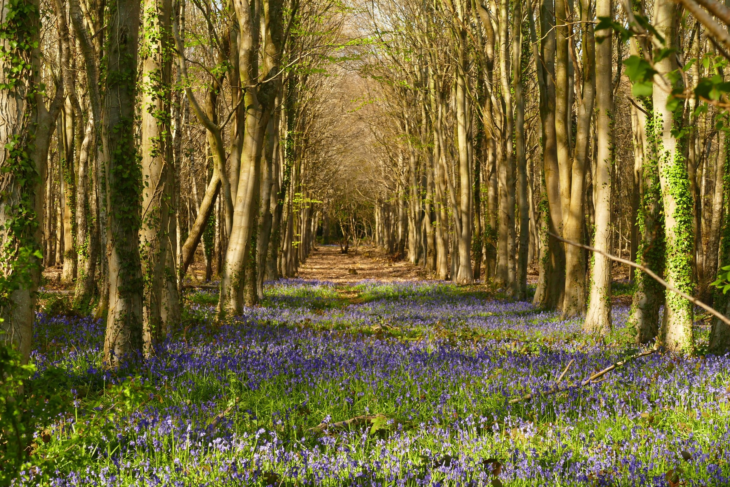
Children will enjoy the wildflowers in summer or a hot chocolate from the van in winter.

Linseed/flax is usually grown on the farmland at Cheesefoot Head
The Basics
Time: 40 mins
Distance: 2.6 km
Terrain: Wide, gravelled farm track then some narrower, rougher paths
Pushchair: No
Dogs: Yes, but farmer requests them to be on leads and not to run in the crops
Refreshments: Baker and White coffee van in the car park (Thursday - Sunday 07:30 - 16:30)
Toilets: None
Public Transport: None
Parking: Cheesefoot Head car park, small but free - see the big brown sign on the A272 (Postcode: SO24 0HU - W3W: lawful/forgiving/ranked)

Other wild-flowers grow on the verges and the views are spectacular
On the downs above Winchester, the quirkily named Cheesefoot Head is an area of far reaching views with a network of paths including the South Downs Way. In the summer there are meadows of wildflowers and often fields of blue linseed - note that there is no linseed as yet in 2025.
The Route
a. Turn left out of the car park and walk along the verge of the of the A272. After about 20 metres, cross the road into the gateway. Go through the gate and join the Allan King Way along the farm track.
1.b. The start of this walk may pose concern for families, so to avoid the busy road you could start the walk from the car park in the other direction via the little gate and path parallel to the road. Cross the road at the end of the path, following The South Downs Way. Cross the field and then take the path on your left at a crosspath. This path will soon open up into a field. Head left here to reach a gravelled track. Walk up until you hit The Allan King Way mentioned in step 1a. Turn right and walk away from the road.
The path continues long and straight and it is here that in 2024, you will see linseed/flax to your left. Farmers often rotate their crops, so there is no guarantee that these exact same fields will flower again in 2025, but there were plenty of other wild flowers lining the path to enjoy.
Take the second path on your left, opposite a line of trees. Head into a little copse and then emerge in a meadow. Follow the path across the meadow to the line of trees on the other side. Go through the gate on your left.
Head left and then follow the footpath sign to the left of the trees and with the fence on your left. Turn left at the end of the fence and walk to re-join the original path.
Turn right at the path junction and head back to the road.
We suggest viewing the interactive map below as a ‘Trails Map’ to ensure all the paths are visible.


Did you know?
Intriguingly, nobody seems to know how this beauty spot got the less than beautiful name of Cheesefoot. We would be interested to know if you have any theories!
We are passionate about keeping The Ambling Path as a free resource available to everyone, forever. If you have enjoyed using our walking guides, then please consider leaving us a donation. This will help to cover our costs as well as rewarding the considerable time and effort needed to maintain the site. Thank you.
Follow us on social media to see our new walks and get regular updates on our old ones: