Chilworth Gunpowder Mills & St. Martha’s Hill
Guildford
Children will love exploring the ruins of the gunpowder works which are scattered through the woodland, as well as playing in the River Tillingbourne.

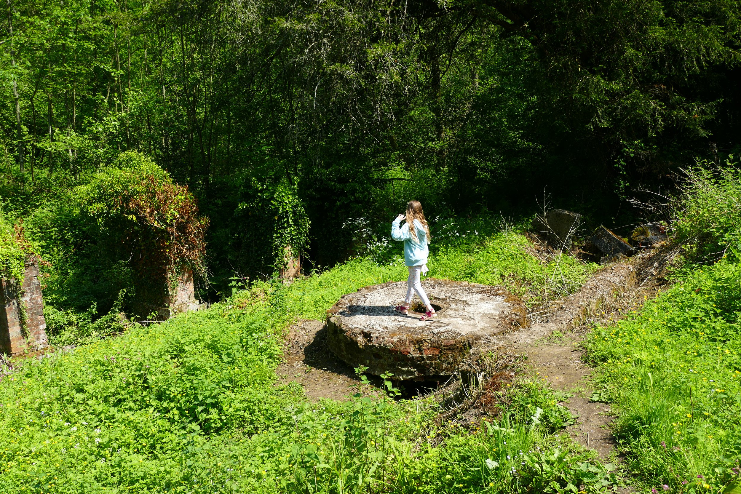
Some of the huge mill stones left behind
The Basics - Chilworth Gunpowder Mills Only
Time: 40 minutes
Distance: 2 km / 1.3 miles
Terrain: Flat, unsurfaced woodland paths.
Pushchair: Pushchairs should be able to make it around, but it may be a little bumpy in places and expect a little mud in winter.
Dogs: Dogs are welcome on this walk and they may also enjoy the paddling area.
Refreshments: There is a picnic area in a woodland clearing, or you could start this walk from The Percy Arms in Chilworth. Ambling Path members can receive a free Bos ice tea (lemon or peach) with every kid’s meal purchased from The Percy Arms. Show your digital Ambling Path Members card to qualify. View the kid’s menu here.
Toilets: There are no public toilets.
Public Transport: Trains run to Chilworth, from where you can walk from the station to the gunpowder mills via Vera’s Path mentioned below.
Parking: There are three free spaces for visitors to the mills on Blacksmith Lane opposite West Lodge (Postcode: GU4 8NQ - W3W: ///photos.punks.charge). If these spaces are full, we recommend finding parking in Chilworth village on roads near the infant school.

A designated area for children and dogs to paddle in
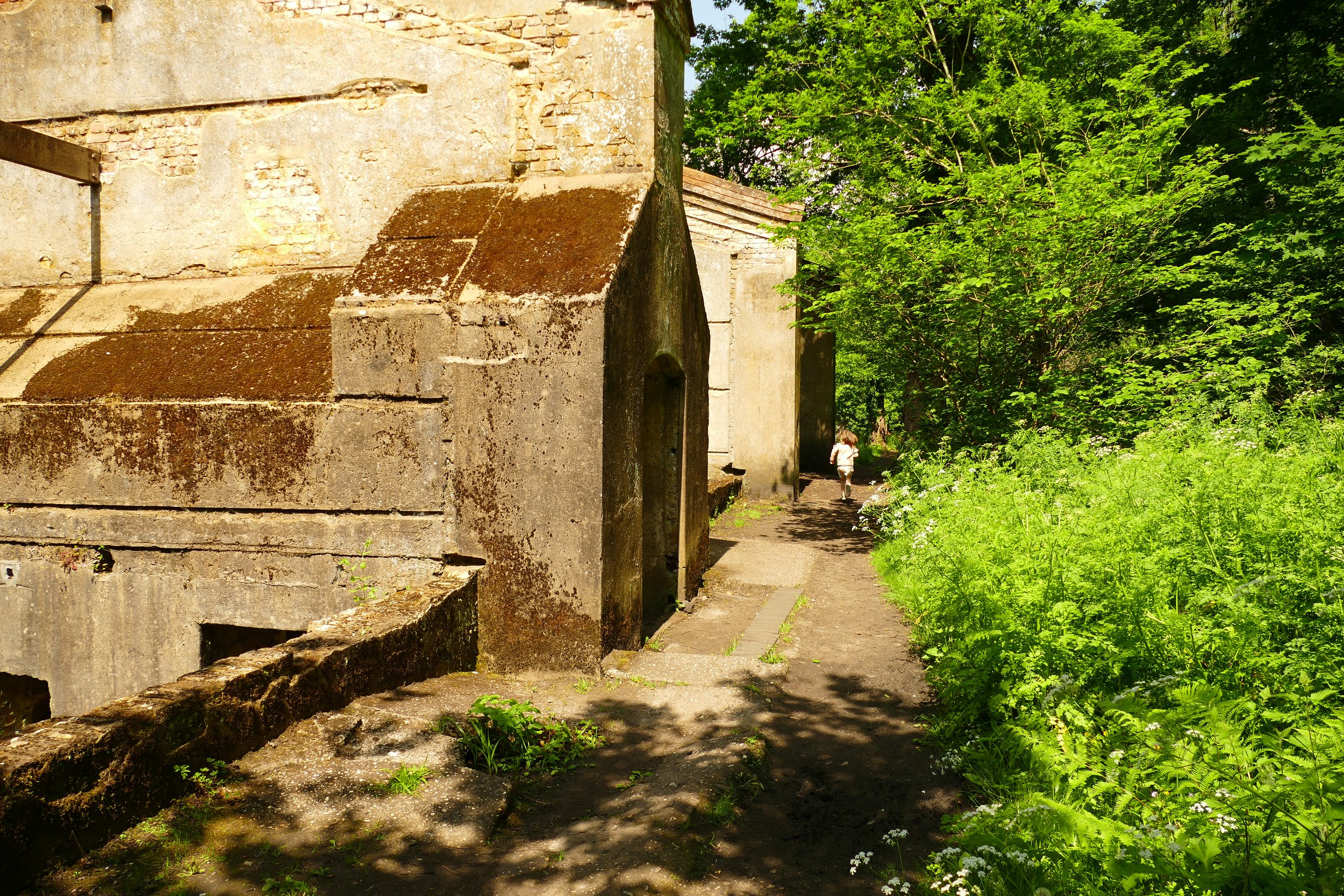
In woodland beside the River Tillingbourne lies the scheduled ancient monument of Chilworth Gunpowder Mills. It may not seem like it today, but the area was once a hive of industry and hidden among the trees, you will find the ruins of buildings, millstones, channels and bridges. In one of the channels, you will even find a designated paddling spot where children can play in the shallow water.
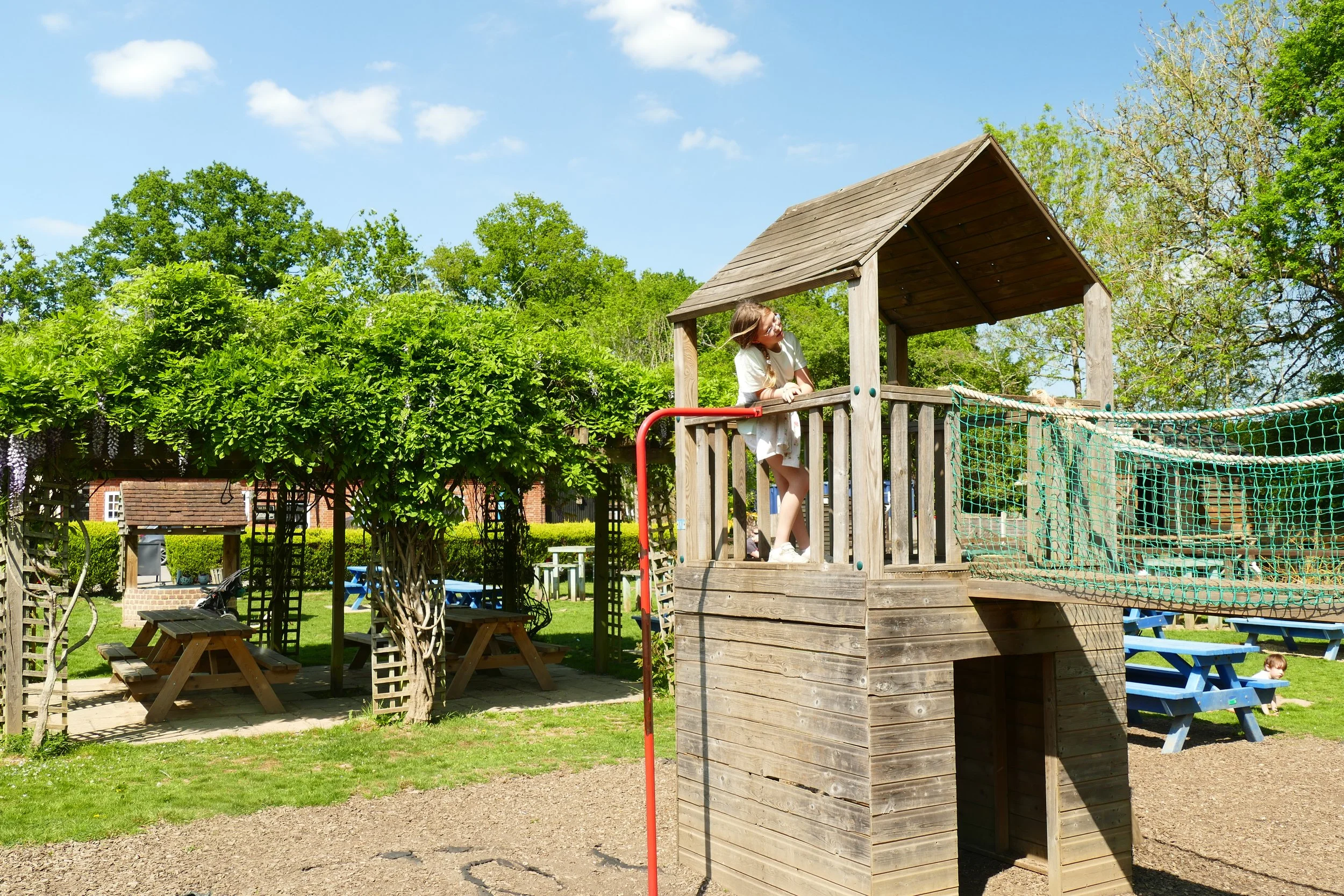
The exploration can easily be extended to The Percy Arms, which has a large garden with the river running though it and a good sized play area.
If you want to see even more of the area, then our guide also tells you how to begin a circular route to Chilworth from the top of St. Martha’s Hill with its striking church and views of the Surrey Hills (scroll down this page).
The Route - Chilworth Gunpowder Mills Only
If starting from Blacksmith’s Lane:
Cross the lane from the small parking area and enter the woodland opposite on the path to the left of the lodge. The walk is now incredibly easy to follow as it will pretty much go in a straight line. There are some small paths to the left and right, which you should initially ignore. All of the main ruins will be visible from the path or just to the side of it.
About half way through the walk, you will come to a picnic area in a grassy clearing.
The path continues east, passing the designated paddling spot with a snail sculpture.
The most in-tact of the ruins will come into view after this - perfect for a game of hide and seek! The path will come to an end when you reach Lockner Farm Lane.
To vary the route back slightly, exit onto the lane and turn left. After about twenty metres, you will see a metal kissing gate on your left, taking you back into the site. There is another spot where children can play in the river here. Follow this around the back of the ruins until you return to the main path just before the picnic site.
You can also take another variant just after the picnic site by turning right down the secondary path. This will take you along the river and past another spot where children can play in the water. Do not go over the flat wooden bridge, but instead fork left to return to the main path.
If starting from Chilworth village:
Begin the walk next to Chilworth Infant School. The path is called Vera’s Path and it is clearly signed. Follow the path into the woodland and arrive at the gunpowder mills via a little footbridge. The first thing you will see is the picnic area ahead of you.
Turn right and you will soon come to the paddling area and then a series of ruined buildings. Turn left when you arrive at Lockner Farm Lane.
Very shortly, re-enter the works via the next gate on your left. There is another place here where dogs and children can play in the river. Follow this path around the back of the ruins until you return to the main path just before the picnic site.
Pass the picnic site and then fork right along the minor path. You will come down to another point where you can play at the river. Do not cross the wooden sleeper bridge, but instead fork left and return to the main path. You can continue on this path until you reach the Lodge and Blacksmith’s Lane.
You will have now passed all of the historic points and should return along the path in a straight line back to the picnic area and exit via Vera’s path again.
The Percy Arms is just past the infant school on the main street. It has a children’s play area and the river runs through the garden.
The main points of interest through the gunpowder mills have QR codes on posts if you would like to know more about their place in the industrial past.
As a member, you gain instant access to all 133 PDF files in our PDF library. You also get a digital membership card that allows you to benefit from special members-only discounts at some of our favourite pit-stops on the walks.


Did you know?
What seems like a natural space actually owes its existence to our industrial heritage. The tracks and waterways were all built to serve 300 years of gunpowder manufacture that only ceased at the end of the second world war.
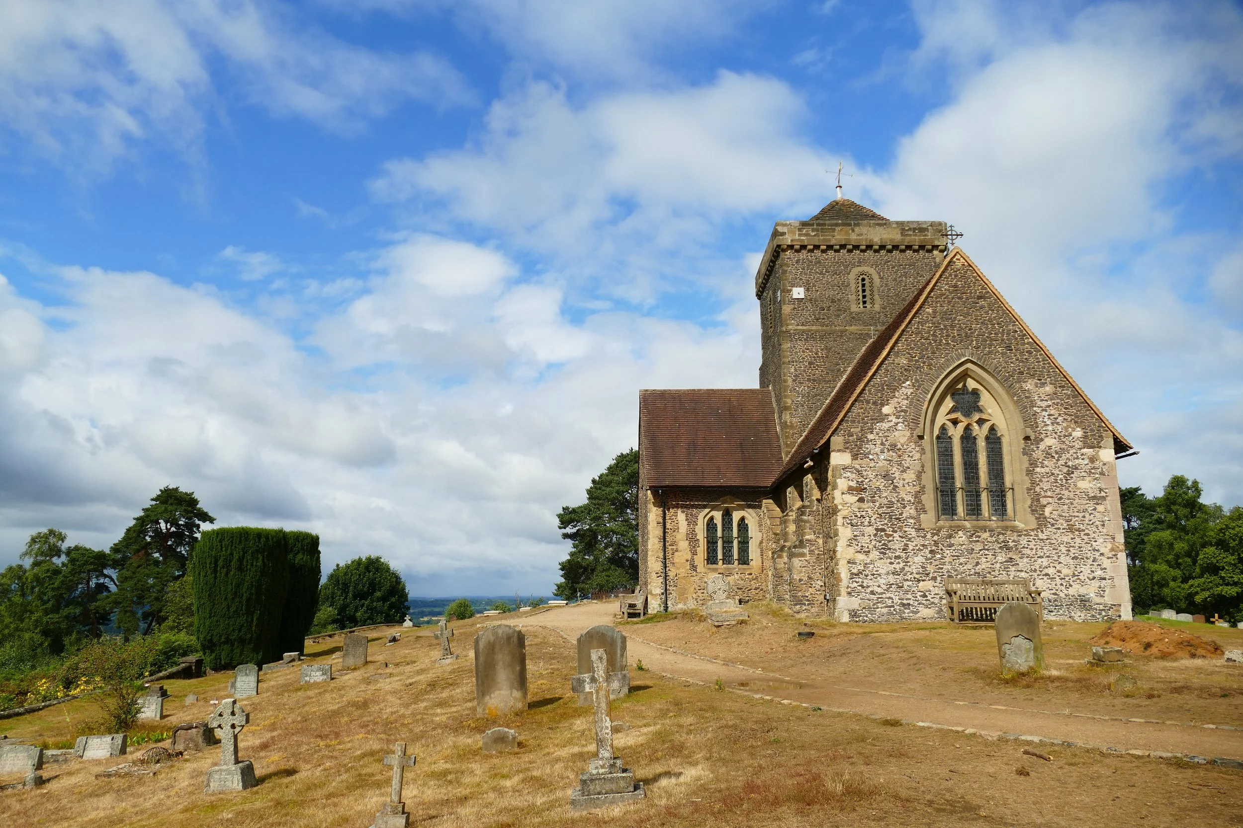
St. Martha’s Church has a commanding position over the Surrey Hills
The Basics - St. Martha’s Hill to Chilworth Gunpowder Mills
Time: 1 hr 30 mins
Distance: 4.2 km / 2.6 miles
Terrain: A mixture of well surfaced tracks and some rough, sandy paths that are very narrow. This route also includes a very steep ascent on a rough path.
Pushchair: This route is not suitable for pushchairs.
Dogs: Dogs are welcome on this walk and they may also enjoy the paddling area.
Refreshments: There is a picnic area at Chilworth Gunpowder Mills, on summer weekends tea and coffee is served at the church by volunteers, or you could extend this walk to The Percy Arms in Chilworth. Ambling Path members can receive a free Bos ice tea (lemon or peach) with every kid’s meal purchased from The Percy Arms. Show your digital Ambling Path Members card to qualify. View the kid’s menu here.
Toilets: There are no public toilets.
Public Transport: Trains run to Chilworth, from where you can walk from the station to the gunpowder mills via Vera’s Path next to the school and start this walk from there.
Parking: A good sized parking area off Halfpenny Lane, free (Postcode: GU4 8PZ - W3W: ///unless.feast.behind)
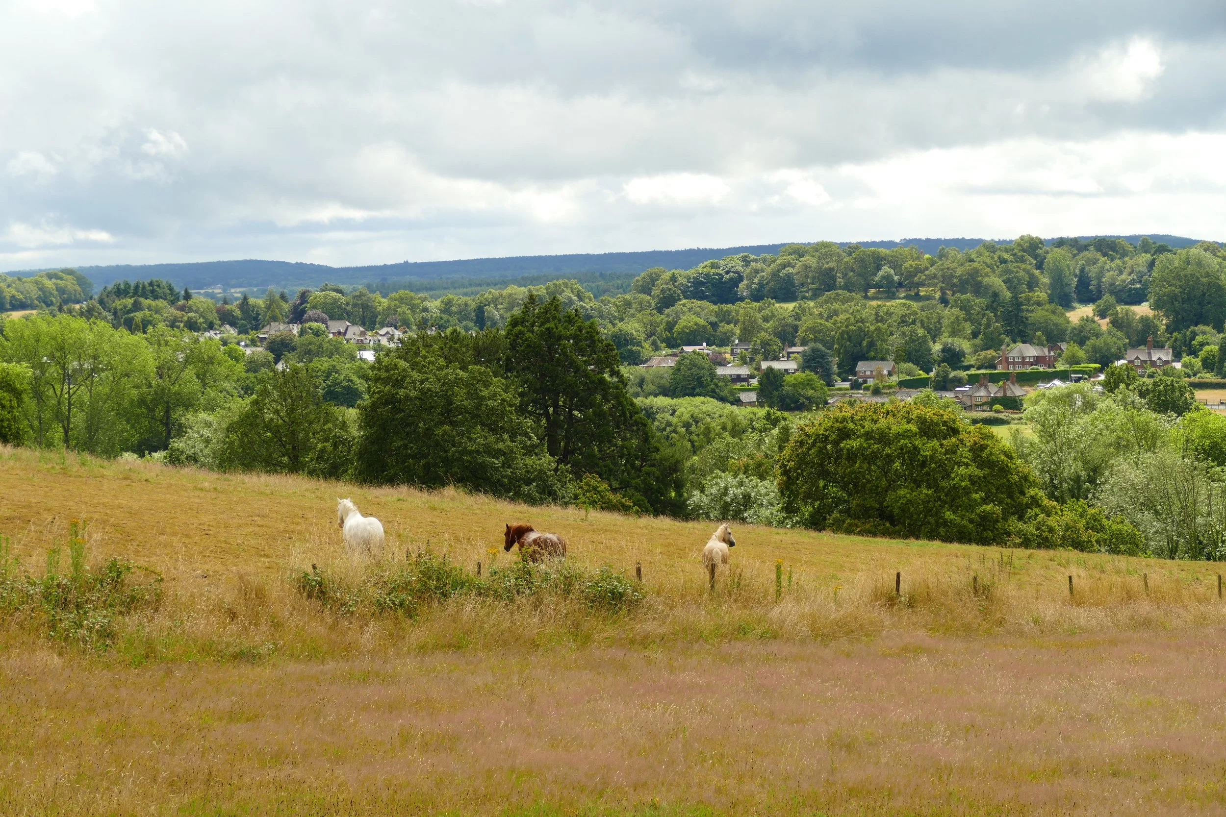
Views on the descent from St. Martha’s Hill
The Route - St. Martha’s Hill to Chilworth Gunpowder Mills
Leave the car park up the track leading off behind the information board. This will rise steadily up the sandy wooded hillside. When a path forks off to the right, ignore it and continue forward, following the North Downs Way.
At the top of the hill, you will arrive at St. Martha’s Church, which is in a wonderfully isolated position on top of the hill. There are lots of benches in the churchyard where you can stop and admire the view and if the doors are unlocked, you can look inside. On summer weekends, volunteers sell homemade cakes and teas for a ‘pay what you feel’ donation. The volunteers even let our kids ring the church bell!
After enjoying the church, continue out the gate on the other side of the churchyard, continuing in the same direction from which you came. On your right will be a small wooden fence with the views beyond. As the fence comes to and end, continue straight. The sandy path has suffered significant erosion and it now becomes quite rough as it makes its way downwards.
Keep heading downwards, passing a public bridleway sign on your right which you should ignore. At a fork with The North Downs Way and another bridlepath, follow the right fork on the bridlepath and then immediately go right before you get to the pillbox, almost heading back on yourself onto the Downs Link pathway. You will see a stone marker for this at the point where you should double back.
Descend on the narrow sandy path until you reach an entrance to Chilworth Manor Vineyard and Bug Manor on your right. Veer left onto the much wider access track. Veer right at the entrance to Longfrey Farm and cross over The Tillingbourne.
As you hit Lockner Farm Lane, you will see a gate on your right going into Chilworth Gunpowder Mills. Ignore this, and continue a few metres to the next entrance through a gap in the fence. You will see a noticeboard and a metal water pipe.
Take the path through the woodland, first passing a series of ruined buildings to your right (you can pick up a leaflet at the noticeboard or use the QR codes if you want to know more). Just past the buildings, you will come to a little area where children can play in the water with a snail carving they can climb on.
Continue forward to the picnic area. If you want to visit the Percy Arms, take Vera’s Path on your left as you walk through the picnic area. You will go over a little bridge and then walk in a straight line to Chilworth Village. Turn left at the road to find the pub. The pub specialises in South African cuisine and has a large garden that the river runs through, as well as a children’s play area. If you are not visiting the pub, continue forward after the picnic area and look for a right-hand fork onto a slimmer secondary path.
Take this path as it brings you down to the river again (if you want to see more of the Gunpowder Mills, you would need to carry on along the main path until you get to Blacksmith’s Lane and then return to this point). Cross the river on a wooden sleeper bridge and then immediately turn left along the narrow path.
You will initially walk with water to your left and right, then the path will head right up some steps. You will pass a paddock with alpacas in to your left and then at a cross path, keep going upwards on the path clearly signed to St. Martha’s. The path starts off very narrow and then gets considerably steep. Keep going until you reach the top and another cross paths.
Continue straight at the cross path and you will see the church ahead of you. Retrace your steps to the car park.
As a member, you gain instant access to all 133 PDF files in our PDF library. You also get a digital membership card that allows you to benefit from special members-only discounts at some of our favourite pit-stops on the walks.
If you enjoyed this walk…
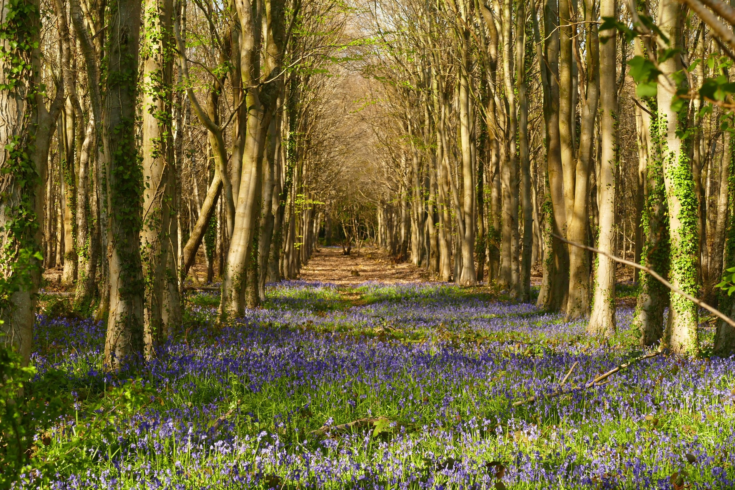
…try this one at the Chantries which is served by the same car park and is one of the best places to spot bluebells in spring.
Follow us on social media to see our new walks and get regular updates on our old ones: